After making lots of laser cut boxes, i was wanted to try making a more interesting 3D shape such as a topographical map of my favourite island of Lantau. There are quite a few ways to do this, with the easiest way probably via an STL file but as i’m not familiar with any 3D printing programs to do the slicing, this did not give me a good result. I opted for the more flexible way of using a GIS package and import a Digital Elevation Model to create contours, as explained here.
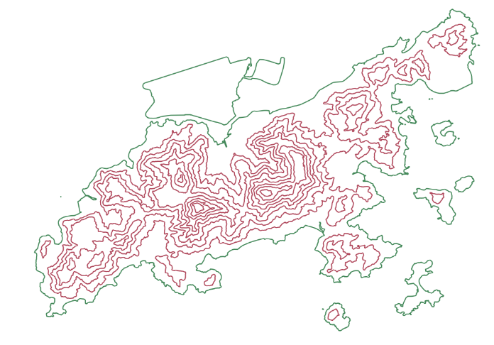
The DEM i used is the global SRTM dataset, available from USGS. Its resolution is around 90m which gives good results for an area like Hong Kong. I used the open source QGIS to generate the contours, which worked well except for the 0m contour: it did not look like the correct coastline. So i ended up importing the coastline from OpenStreetMap. I filtered the contours to eliminate the lines shorter than 1km. Below picture shows the OSM coastline in green and the contours in purple, per 100 meter interval.
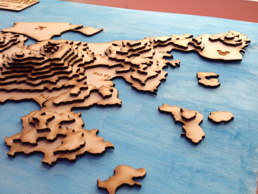
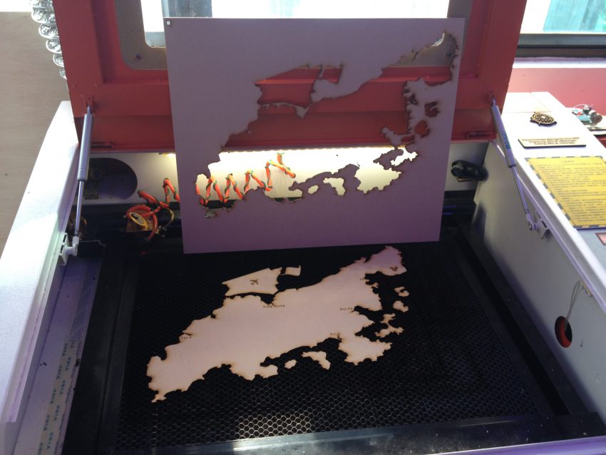
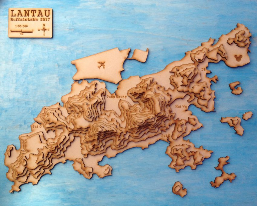
Then i created 9 files, one for each level (coastline, 100m contour, …up to 800m contour), and proceeding to cut them out of 3mm MDF. I glued them layer by layer on a blue background.
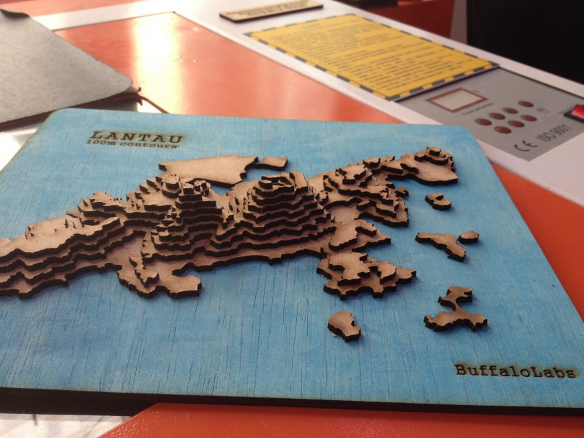
This looked good so i decided to make a larger version, as large as the laser cutter would allow me (600mm x 400mm cutting area). I ended up with a scale of 1:50,000.
I also added the names of the major towns, and some symbols by laser engraving. I considered including the roads and trails but that involves a lot of work to separate the sections in the different layers; maybe later.

Great job Sir Tom